


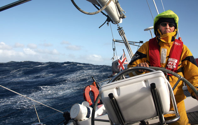
Spikes in wind strength can range from a blustery sail to survival conditions. Dag Pike explains how to predict which it will be and what to do when the wind hits

Sailing in gusts and squalls. How to deal with spikes in wind strength
The atmosphere is a pretty turbulent place and this turbulence occurs on several levels of scale, writes Dag Pike.
On a global scale there are the major high and low pressure areas with the wind circulating round them.
Then there can be the more local areas of turbulence, which we know and love as the high and low pressure areas that are typically noted on the weather forecast.
Gusts
On a very local scale there are gusts of wind that may only exist over an area of perhaps a few hundred metres.
Whilst these gusts may not be particularly significant in the greater scheme of things, gusts can present a challenging situation for yachts because they can upset the equilibrium of a nice day’s sailing.
As a rule of thumb, the wind is never steady and it will constantly vary in both strength and direction.
Gusts are generally short lived, but because the wind speed can temporarily double in speed over a very local area they can pose a significant challenge to yachts.
The increased wind strength in the gusts may only last for a few minutes and this does not give time for the sea conditions to change appreciably, but that increase in wind strength can upset your carefully set sails.
You can sometimes be aware of gusts approaching by the local disturbance they create on the surface of the sea but you are only likely to see this in relatively calm conditions such as inside a harbour.
Out at sea the disturbance of the sea surface is likely to be lost in the general surface disturbance of the waves although you may see spray being blown off the tops of the waves due to the increased wind strength.
Planning for wind changes
You are much more likely to find gusts close to shore where the flow of the wind will be more uneven due to the interference from the land particularly when there are cliffs or high ground.
While pressure systems are caused mainly by temperature differences, gusts are most often the result of the interaction between the wind and the surface of the land or sea.
Hills, woodland and other shore-based obstructions disrupt the flow of air, and mountains can cause turbulence several miles out to sea.
Gusts still occur in open water, where friction between the lower air flow and the sea will slow the wind down to a degree but higher up the wind remains more consistent.
This slowing down at the surface causes uneven sheering and turbulence in the airflow and is the main cause of wind gusts at sea.

Marine weather forecasts will predict the force of the mean wind speed, which allows for gusts to potentially a whole force or higher. For a more accurate estimate of possible gust strength, Dag Pike uses this table to factor for the mean and maximum strength of gusts at day and at night
The increase of the wind strength within a gust can be quite considerable, as the table above shows.
It tends to vary with the wind strength.
With a Force 3 wind the strength can double in a gust, but when you get to Force 5 the gust increase is more modest but can still be significant.
The strength of gusts also decreases somewhat at night, which is a blessing, as you will get little or no indication of the arrival of a gust in the dark.
Another factor to consider when there are gusts is that there will be short-term changes in the wind direction.
In open water in the Northern Hemisphere the wind will veer clockwise, and the amount of change in direction is largely dictated by the strength of the gust, but is likely to be in the order of 15° to 20°.
In the Southern Hemisphere, the veer direction is anticlockwise.

Along a cold front, individual squalls can join up into an intimidating line squall. Credit: Alamy
For those of us in the Northern Hemisphere, then this directional change is not too much of a problem if you are on starboard tack but you will be headed if you are on port tack.
Of course, once the gust has passed the wind should return to its original direction, at least until the next gust comes along.
Because gusts of wind will arrive with little or no warning, the arrival of a gust means that you will have little time to respond to the increase in wind speed.
Active trimming of the mainsail and responding with the helm is normally sufficient.
But for cruising sailors with small crews over longer distances, it is not good practice to carry excessive sail for the average wind conditions you are experiencing, so that you have a measure of reserve to cope with the gust without having to trim like a racing crew.
Sailing in squalls
Squalls are different from gusts in that they are more predictable, at least in the short term, and you are more likely to get some warning of their arrival, at least in daylight.
Because the clues are visual, squall detection at night can present problems and their arrival is likely to be more sudden.
Squalls tend to be found where two airflows mix or where there is a rising airflow due to surface warming.
You will almost certainly find squalls along a cold front due to the intensity of the front and the sudden mixing of the cold and warm air masses.

Airflow off the land is likely to be more turbulent, and sail area should be set more conservatively. Credit: Graham Snook/Yachting Monthly
Along a cold front the squalls can merge together into line squalls which can be quite daunting with the possibility of waterspouts and violent winds.
Squalls are less likely along a warm front where the mixing of the airflows is more gradual and there is less chance of finding squalls in an occluded front where conditions tend to be less active.
Squalls of a milder form can be found under areas of cloud where the cloud indicates that there is a mixing of air as warmer air rises.
These will often be found in the afternoon as the air temperature rises.
This causes the warmed air to rise, leaving a vacuum into which the colder air rushes to fill the vacated space, hence the creation of the squall.
The increase in the wind strength in such a squall is likely to be moderate due to the less intense nature of the activity but such a temporary increase in wind strength can be useful for yachts if you can detect it on a day of light winds.
Once the rain starts, the airflow can reverse downward, creating strong squalls under the cloud.
This type of squall will be found mostly in the summer when the local heating can be more intense.
Spotting a squall
Squalls can often be found near land when the wind is stronger, particularly if the wind is off the land or along the coastline and the land is fairly high.
In this situation it is the land that interferes with the flow of air and creates eddies in the flow that can develop into squalls.
The air above the land also heats more than above the sea, again causing the temperature difference that can lead to a squall.
A squall can last up to an hour but is more likely to be of shorter duration and in most cases it will be no more that 15 minutes.

Airflow off the land, particularly around cliffs and hills, can lead to dramatic localised gusts. Credit: Ken Endean
The cloud activity is likely to be your early warning sign of an approaching squall and you can expect to experience quite sharp squalls when you see more intense cloud activity.
Severe squalls tend to occur in thunderstorms and even without this type of intense activity a squall will often be accompanied by rain, which will help you to identify its presence from a distance.
You can track the progress of a squall on radar if it is associated with rain, which can be useful if you want to take action to avoid it.
At night the detection of squalls can be difficult but then they are less likely to occur in the dark.
There will be little in the way of any visual indication until the squall hits you, although if there is rain associated with the squall it should be visible on radar.

Low storm clouds, and particularly rain showers, are often visible on radar, giving you some warning
Like gusts, the wind direction will change when a squall is approaching and veering is the standard change of direction.
Because of their longer duration you may want to consider a shortening of sail for the duration of the squall but you may get some idea of the intensity of the approaching squall by the change in the sea conditions.
Small white horses or spray being whipped up off the waves could show a considerable increase in the wind speed coming your way.
Longer duration squalls can lead to an appreciable increase in the size of the waves.
Don’t underestimate a storm
You tend to think of thunderstorms as just bringing heavy rain and reduced visibility for a while, perhaps associated with some spectacular lightning displays.
However, do not underestimate thunderstorms as they can represent one of the more violent forms of local weather.
They can produce some quite violent local winds with short-term changes in both wind strength and direction.

In a thunderstorm, the increase in wind strength can be dramatic and sustained. Credit: Alamy
Whilst these are not likely to last long enough to generate any serious change in the sea conditions, it is suggested that with a thunderstorm approaching you shorten sail.
They are probably the most intense type of squall that you will experience and you should expect to find them when a cold front is passing through.
Gusts, squalls and thunderstorms can keep you on your toes when sailing and as Alan Watts says in one of his many weather books: ‘The wind is never steady but at times it is steadier than others’.

Dag Pike is one of the UK’s best-known nautical journalists and authors, covering both sailing and motor boating for many years.
Reading rainclouds for wind
Professional weather router Christ Tibbs explains how to read the signs of a rain cloud to know what wind to expect
For UK sailors, April is a month of contrasts and can quickly slip from warm sunshine to hail or snow.
We talk about ‘April showers’, yet March is often more showery than April.
It is at this time, and in the autumn too, that we are most likely to experience sudden rain when out on the water.
In the spring, as the northern hemisphere warms, the jet stream moves north, giving plenty of cool, west and northwesterly winds and a greater likelihood of showers.

Rain showers are often associated with descending air and strong squalls beneath. Credit: Alamy
In the autumn as things in the north cool, the jet stream returns south once again providing our first tastes of the autumn showers and breezier conditions.
In Spring, the seas and air above them are still cold, but as the land heats cumulus and cumulonimbus clouds will bubble up.
A typical day starts clear, with small clouds appearing late morning.
During the afternoon these grow, developing ‘anvil’ heads and showers, often of hail.
Continues below…

How to build your own weather forecast
Building your own bespoke weather forecast is the best way to get reliable weather updates so you can make better…
Heavy weather sailing: preparing for extreme conditions
Alastair Buchan and other expert ocean cruisers explain how best to prepare when you’ve been ‘caught out’ and end up…

Adventure: guide to sailing in storms
Award-winning sailor and expedition leader Bob Shepton regularly sails some of the most storm-swept latitudes in the world. Not bad…

How to reef to sail safely through any weather
Pete Goss delivers his masterclass on when to reef, and explains why it is critical to keeping control of your…
By evening the clouds tend to disappear, leaving a cold, frosty night.
All sailors should take heed, as these clouds bring squally winds.
Small gusts are likely around the clouds when they are building, with lighter wind underneath – these are ‘sucking clouds’, as much energy, moisture and air is going into their development.
Once rain or hail starts to fall, they can be described as ‘blowing’: severe downdrafts will occur as the precipitation starts.
In extreme cases, these can give gusts of more than gale force as air and hail from aloft hit the water and spread out.

Watch for building cumulus clouds, which indicate warm air rising and the beginning of a possible squall. Credit: Graham Snook/Yachting Monthly
It is well worth reefing before the precipitation arrives, as the wind may arrive ahead of it.
It’s important to understand the terms used in forecasts.
Gusts in showers are not generally mentioned in forecasts but the word ‘showers’ is a definite indication of strong gusts.
Showers are from convective clouds (cumulonimbus) and give big gusts and squalls.
Intermittent rain is from layer (stratus) cloud and whilst there may be a general increase in wind, it will not create squalls.
Enjoyed reading this?
A subscription to Yachting Monthly magazine costs around 40% less than the cover price.
Print and digital editions are available through Magazines Direct – where you can also find the latest deals.
YM is packed with information to help you get the most from your time on the water.
- Take your seamanship to the next level with tips, advice and skills from our experts
- Impartial in-depth reviews of the latest yachts and equipment
- Cruising guides to help you reach those dream destinations
Follow us on Facebook, Twitter and Instagram.