


With the high cost of marine electronics, phone apps offer a plethora of affordable navigation data at your fingertips, says Sam Fortescue

There’s almost nowhere the mobile phone hasn’t made inroads, and boats are no exception. Hundreds of sailing apps are now available.
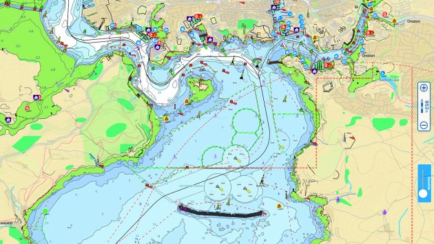
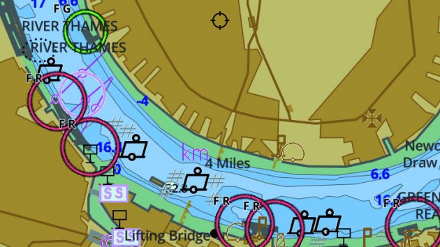
Chart viewing is among the most obvious functions, since we are already accustomed to using a dedicated screen aboard for that.
A repeater or a display for NMEA data is another popular use for the phone – hardly surprising when you consider that a basic chartplotter can set you back £1,000 and even an instrument display these days costs north of £500.
There are dedicated apps for these two key functions, and some of the better ones combine both so you can use the phone as a chartplotter.
The enormous processing power of your mobile makes light of rendering charts. Phones can also make light of heavy pilot guides.

Chartering apps have grown considerably over the last few years, allowing you to easily book your holiday. Credit: Getty
I wouldn’t dream of suggesting you dispense with your treasured sailing library, but their digital versions can provide a handy backup.
A host of sailing apps have grown up around providing key cruising data to enable you to get safely into a new port.
These are often smart versions of familiar friends.
But they can go one step further than those beautiful hardcover guides that cost £40-50 a pop.
That’s because they can be updated in real time and annotated by other users.
From off-the-beaten-track anchorages to advice about the best cliff walks and the finest pint/sangria/rum punch – the social nature of cruising makes it ideal for crowdsourcing this sort of content.
It answers a perennial complaint in my household, that pilot guides tell you how to get somewhere but not why to go there.
Like other crowdsourced info, the trick has been to find a light-touch way of moderating the data to ensure it is correct, clean and not libellous!
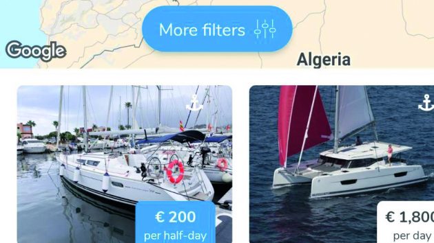
Chartering is the other obvious service that can be performed by sailing apps.
Think of these as a supercharged version of the time-honoured charter broker, with tens of thousands of boats on their books.
Searching is easy thanks to a range of smart filters and prices are up to 50% lower than the headline.
You can also use some of these sailing apps to rent out your own boat, or to charter someone else’s.
There are many other genres in the canon of sailing apps, which we will be exploring in future issues of Yachting Monthly…
Sailing Apps: Charting
Mobile phones and tablets make great chartplotters, with their built-in GPS and powerful processors.
While they aren’t waterproof and need to be kept charged, you’ll already be familiar with intuitive control gestures such as pinch-to-zoom.
All these sailing apps make it easy to browse for charts in their dedicated stores, and, although you never physically own the charts as you would with a chart card, the annual subscription model can be cost-effective, with coverage starting at £2.49.
If your heart is set on the very latest charting, complete with 1ft depth contours and custom shading, then you will gravitate towards the apps from the big two charting providers: Navionics and C-Map.
They provide the best detail and features, but usually with a price to match (www.yachtingmonthly.com/digitalcharts).
If you want a back-up system or are chart agnostic, then there are a host of cheaper options, which we explore below.
They offer many of the same features, including NMEA data display in-app, automatic route planning and user-generated sonar data.
Some apps also run to weather and tide data, although most charge a little extra for this.
Bear in mind that you will need a plotter or wifi bridge capable of transferring instrument data via wifi if you want to use the NMEA input on your phone or tablet.
SAVVY NAVVY
£34.99 (Essential); £59.99 (Explore); £64.99 (Elite)

A serious all-rounder combining charts, navigation and tidal data, weather forecasts and marina/anchorage guides and doing so rather well.
HO data is used for charts, and coverage is mostly good in the US, Europe and the Caribbean. Key exceptions are Denmark, Portugal and Turkey.
The auto-routing function can manage a multi-day passage.
An Explore or Elite subscription can also sync routes to your plotter, and overlay detailed tidal and weather data for an intuitive picture, and scroll through tidal heights.
Marina and anchorage guides cover the key marine services and shoreside amenities.
Charts can be used offline (not Essential pack). Elite adds a tidal stream atlas, satellite imagery and night mode. www.savvy-navvy.com
Buy Savvy Navvy for iPhones at the Apple App Store
Buy Savvy Navvy for Android at Google Play
AQUA MAP
Free app. £19.99 UK and Ireland
Specifically developed for Apple devices with Retina screens, Aqua Map uses official hydrographic office (HO) data to create its digital charts.
These you can access for a very reasonable annual fee.
The UK and Ireland package includes the Scottish islands, Channel Islands and even the Faroes. You can download the chart tiles you need for offline use.
The interface allows you to drop waypoints and plot routes, which you can transfer in from other devices and export.
This function also allows you to share your track on Facebook and with other Aqua Map users.
It is the only app that is also compatible with Garmin’s ActiveCaptain app. www.globalaquamap.com
Get Aqua Map for iPhones at the Apple App Store
Get Aqua Map for Android at Google Play
SEANAV
Free app. £19.99 UK and Ireland charts

This is a hugely capable navigation suite with chart coverage of the US and Europe based on hydrographic office data.
There are free updates for 12 months, depth shading and you can view charts offline.
It is quick to set up waypoints and routes, with the ability to import and export to other devices.
Live AIS data (including a collision alarm) can be streamed over a web connection if you take the ‘pro features’ upgrade for an extra £9.99 per year.
Another nice feature is the augmented reality view, which combines the image from your phone’s camera with chart and AIS data, helping you identify what you can see in front of you. Only for iPhones or iPads. www.pocketmariner.com
Get Seanav for iPhones at the Apple App Store
INAVX
£4.49 app; £46 world chart

Claiming to be the world’s number one ‘handheld chartplotter’, iNavX has global chart coverage through a tie-up with various publishers.
For European waters, it is Delius Klasing, as well as a world map from C-Map.
Navionics no longer licenses its charts through iNavX, so the developers have created their own Professional+ worldwide vector chart instead.
The app turns your smart device into a plotter screen, with panning and zooming, waypoints, routes and a track log. Much of this data can be exported.
What’s more, it can receive and display NMEA data over wifi, and integrate with an external GPS and AIS.
Additional features include Theyr weather (£36.99), tides and an anchor alarm. www.inavx.com
Buy Inavx for iPhones at the Apple App Store
Buy Inavx for Android at Google Play
I-BOATING
Free app. UK and Ireland charts £25.99
European coverage includes the UK/Ireland, Germany and the Netherlands, with charts that look a little simplistic but are easy to read.
Data comes from the UKHO in home waters, and you can toggle between imperial and metric units.
There’s a satellite overlay, road atlas and custom depth shading. Waypoints and routes can be imported, exported and easily set up in the app.
It records your track and allows you to query details about charted objects with a long press on the screen.
The other main selling point is autoguidance with voice prompts.
You can pipe in NMEA data via wifi, plus there is tide data available for the UK and Germany for no extra cost. www.gpsnauticalcharts.com
Get Iboating for iPhones at the Apple App Store
Get Iboating for Android at Google Play
Also on the market
AIS Maps
From £2.49

Combines offline charting with online AIS data. Buy good-looking UK and Ireland charts for £14.99pa or specific areas from £2.49 to £10.99.
Get weather, drop waypoints and set up routes. www.flytomap.com
Buy AIS Maps for iPhone at the Apple App Store
Buy AIS Maps for Android at Google Play
SEAIQ
Free

The only app that allows you to upload your own electronic charts. Supports waypoints and routes, weather data and NMEA data.
Free to download, but some features require the £44.99 upgrade. Android version of the app available via www.seaiq.com
Get Seaiq for iPhone at the Apple App Store
WARTSILA ISAILOR
From £13.99

Splits the UK into four different sea areas, each costing £13.99, which may suit some and infuriate others.
Integrates GPS, NMEA and AIS data along with weather (£21.99), tides and currents (£8.99) and marina guides.
It’s been three years since the last update, and the app looks dated, though Wärtsilä insists it is still supported. For iPhone only. www.isailor.us
Buy Wärtsilä iSailor for iPhone at the Apple App Store
Continues below…

AIS Apps: the pros and the cons
Duncan Kent explains how to choose an AIS app you can rely on at sea

How to plan the perfect charter holiday
Whether you own your own boat or not, chartering offers the opportunity to sail somewhere different without complication. Will Bruton…

Mediterranean sailing: where to cruise
Home to a hugely diverse cruising area, whether on your own boat or on a charter, there are literally dozens…

Cruising after Brexit and sailing in Europe
As Europe begins to open up again for cruising, Lu Heikell looks at the implications of Brexit on UK sailors…
Sailing Apps: Cruising guides
With frequently updated information supplied by hundreds or thousands of users, cruising guides are a natural fit for the app model.
They all tend to work in a similar way, presenting you with a basemap that allows you to zoom in on the area that interests you.
Just as with Google Maps, every location for which there is an entry is represented by a pin.
On a large-scale view, multiple locations combine into a blob with a number that represents how many entries lie beneath.

Having cruising guides on your phone helps you access information quickly and easily
Zoom in and the blobs disaggregate into individual pins – a smart way of plotting the data that doesn’t bog down your view with thousands of spots.
There are a few truly global ones available in English, from the Cruising Association, Imray and Navily.
Note that the CA’s highly regarded Captain’s Mate app is only usable by CA members. After that, every region seems to have its own local heroes.
It is worth browsing for the right one – Harbour Guide has very good coverage of western Greece and the Peloponnese, for instance, but Marina Tips is better on the eastern islands.
The best ones include lots of user-generated data, from little-known anchorages to good food, bars, walks and days out ashore.
CAPTAIN’S MATE
Free. Requires £137 annual Cruising Association membership

The CA has relaunched its CAptain’s Mate app to blend almanac-style port data with members’ cruising reports.
Each location has a page giving an overview of factual information.
Click on the ‘info’ tab and you can see the facilities available – something you can also specify as search criteria, allowing you to identify the nearest port with fuel or fresh water, for instance.
There is not yet any tidal information available, and the chartlets familiar from the Cruising Almanac are also absent.
The members’ reports are gold dust, however, and available under a third tab moderated by a group of 44 editors.
Another nice touch is the ability to locate other nearby members. www.theca.org.uk
Get CAptain’s Mate for iPhone at the Apple App Store
Get CAptain’s Mate for Android at Google Play
NAVILY
Free app. £17.99 for premium features

For advice about good local anchorages, the free-to-use Navily app is excellent.
Coverage runs to 20,000 locations, mainly in Europe and the Caribbean, and features advice on walks, pubs and restaurants.
It is based around Google satellite mapping, allowing you to zoom in in the usual way, then providing several custom location pins to denote anchorages, ports and marinas.
There is a useful traffic light system assessing the quality of an anchorage, and users have uploaded thousands of photos.
The premium version costs £17.99 per year and features a weather tool which gives you a ‘protection score’ out of 100 for any chosen anchorage. www.navily.com
Get Navily for iPhone from the Apple App Store
Get Navily for Android from Google Play
EXPLORE WITH IMRAY
App free. £49.99 annual subscription

Nautical publisher Imray has launched an all-new app which aims to combine navigational and recreational data for 6,000 anchorages.
It blends user reports with the crucial nav info siphoned out of a growing number of Imray pilot guides by some nifty machine learning.
Your click opens up a pane with a chartlet, an image of the location and a series of expandable titles such as ‘contact’, ‘facilities’ and ‘approach’.
A subscription costs £49.99 for the year or £8.99 per month, giving you access to information from every book.
Click the ‘community’ tab and you can access moderated local tips from other subscribers. Data is not yet available offline.
Visit www.explorewithimray.com
ZULU WATERWAYS
Free app

Launched in 2017 as the Wikipedia of cruising sailing, Zulu Waterways is made available free of charge under a creative commons licence.
The interactive map provides the most information around Australian waters, but coverage is worldwide.
At its heart is factual marina and anchorage info contributed by an army of cruisers.
Here you can find information about charted depths, hazards and protection from the wind, plus navigation advice.
But every marker also includes a ‘comment’ tab which is intended as a repository of thoughts, experiences and contributors’ reports. www.zuluwaterways.com
Get Zulu Waterways for iPhone at the Apple App Store
Get Zulu Waterways for Android at Google Play
MARINA GUIDE
App free. Regional subscription from £8.99

There are several versions of this app according to your chosen cruising ground.
It’s available to download as an app covering all of Europe (£16.99) or smaller areas, such as Lake Geneva or the Adriatic.
There is limited coverage of marinas in the German Baltic and New Zealand, but the main focus is on the western Mediterranean, Adriatic and the Swiss lakes.
Key data includes up-to-date contact details, simple harbour maps, a list of facilities, and photos.
Another nice feature is the access to harbour webcams so you can check on the current situation. There is also weather and wind information. Get the Android app at helloskipper.com
Get Marine Guide for iPhone at the Apple App Store
Also on the market
Harbour Guide
Free app. €8/m or €48/yr subscription

A simple guide that does exactly what it says on the tin for 4,800 harbours in Scandinavia and the eastern Adriatic. www.harbourguide.com
Get Harbour Guide for your iPhone at the Apple App Store
Get Harbour Guide for your Android at Google Play
Waterway Guide
From £2.49
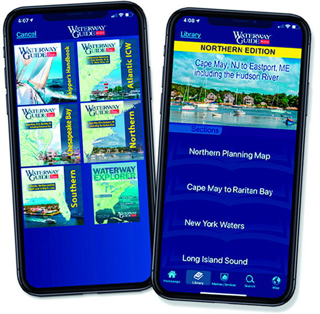
App version of the renowned guides to the US east coast, Bahamas and Cuba.
Vital reading for the Intracoastal Waterway, with bridge heights and marina data.
£2.49 per area. Only for iPhone. www.waterwayguide.com
Buy Waterway Guide for your iPhone at the Apple App Store
MarinaTips
Free. mySea (Greece, Croatia, Italy)

Free interactive guide covering Croatia, Greece and Turkey.
Allows you to book moorings directly, plus marine services and attractions from restaurants to natural parks. www.marinatips.com
Get MarinaTips for your iPhone at the Apple App Store
Get MarinaTips for Android at Google Play
Sailing Apps: Charter
It used to be that you booked a charter holiday through a broker. They were probably dealing with a limited number of fleets and you booked Saturday to Saturday in the time-honoured fashion.
The advent of online charter aggregators has changed all that. With access to over 40,000 boats in some cases, it has never been easier to compare different offers.
The beauty of online platforms is that they allow much greater flexibility than a fleet operator or traditional broker, with single days, part weeks and last-minute bookings possible.
You can select bareboat or skippered, plus a host of other boat options. And they are also generally cheaper, usually offering a discount to the list price up to 30-40%.

Most charter apps offer a discount of up to 40% off list price. Credit: Getty
But these apps go well beyond traditional charter. They were originally developed to enable private owners to rent out their boats when not in use.
‘Peer-to-peer’ charter is still a big part of the offer, and accounts for nearly half of bookings in certain countries, notably France.
Prices here are lower than with a professionally managed charter fleet, although owners have to guarantee the boat is clean and in good condition.
Charterers also have to demonstrate their sailing experience and sign a standard contract. Several of the bigger platforms also offer a luxury yacht charter service, and this is more like traditional brokerage.
The system is not totally automated, so you click through to receive a quote, and a human will help match your specific requirements.
SAMBOAT
Free

French charter platform Samboat may have been swallowed up by Dream Yacht Charter, but it still offers private boat owners a way to earn money through charter.
And with a reported 40,000 yachts on its books, it also includes boats from other charter outfits.
The app launches with a question about where you want to go, and some suggestions.
Once you’ve selected dates and a location, you can apply other filters including boat type, size, engine power and onboard equipment, and even USB sockets, though strangely, there’s no budget filter.
I liked the useful summary of each boat, including a location map and a picture of the owner where the charter is private. www.samboat.com
Get Samboat for your iPhone at the Apple App Store
Get Samboat for your Android at Google Play
BORROW A BOAT
Free

Originally for peer-to-peer boat lending, Borrow a Boat has developed into one of the world’s leading charter portals.
It still allows you to access a private owner’s Beneteau for a weekend on the Dart, but it also includes most big operators worldwide.
BaB has signed up an impressive 35,000 boats in 65 countries, from standard monohulls to luxury cats.
Its selection of yachts was among the broadest and most up to date when we compared the offerings, including many brand-new 2022 boats.
Expect to pay much less than list price, too.
Borrow a Boat Plus is aimed squarely at the luxury market following the acquisition of Helm last year.
Charter the 211ft schooner Atlantic or an 80ft Sunreef cat if money’s no object. www.borrowaboat.com
Get Borrow a Boat for your iPhone at the Apple App Store
Get Borrow a Boat for your Android at Google Play
12 KNOTS
Free

This US app is a little different to the big beasts of the charter market above.
Instead of a vacant search box, you are presented with a map of the world, where each charter base is represented by a pin.
Just like Google maps, the pins are clustered together at large scale and slowly disaggregate as you zoom in, showing the number of boats and bases at each marker.
Besides the obvious criteria of price, location and date, you can set filters including boat type, length and number of cabins, plus a host of other features.
12 Knots has 18,000 boats on its books. Coverage is fair, with Europe and the Caribbean the best represented. There are also scattered bases on both US coasts, SE Asia and the Pacific. www.12knots.com
Get 12 Knots for your iPhone at the Apple App Store
Get 12 Knots for your Android at Google Play
CLICK&BOAT
Free

With French ocean racing legend François Gabart putting his name behind Click&Boat, it certainly has visibility.
It is also the biggest European charter agent, with more than 40,000 boats in 50 countries.
The craft on offer range from RIBs and small daysailers up to vast catamarans and yachts – the latter organised via the Click&Yacht service.
The app itself is a straightforward interface – basically a search engine using dates, boat types and budget as key filters.
You can also specify boat length, year of build and brand. Then you simply enquire or book directly.
The website offers handy pricing guides for different sorts of boat, locations and times. Click&Boat can also help with hotel transfers and bookings. www.clickandboat.com
Get Click & Boat for your iPhone at the Apple App Store
Get Click & Boat for your Android at Google Play
BOATSETTER
Free
Occupying a leading market position in the US, Boatsetter is focused on true peer-to-peer rentals, including a large number of owner-operators for whom this is their livelihood.
The vast majority of its 50,000-strong fleet are motorboats, but does include sail.
Its focus is on US waters, where there are several hundred sailing boats available from Washington state to the Florida Keys.
But it also has a presence in parts of Italy, Spain and Greece, limited to motorboats. Uniquely, the app expects you to book by the hour.
If you are looking for a longer charter you have to click the ‘multi-day trip’.
Pricing is based on multiples of the eight-hour rate making this an expensive way to charter long-term. Ideal for a day trip, though. www.boatsetter.com
Get Boatsetter for your iPhone at the Apple App Store
Get Boatsetter for your Android at Google Play
Also on the market
SAIL.ME
Free
Recently established outfit connecting customers with charter boats. The focus is on sailing boats although, despite the name, there is some power too.
Sensible selection of filters and a range of locations around Europe and the US. Nice map view option. www.sailme.com
Get Sailme for your iPhone at the Apple App Store
Get Sailme for your Android at Google Play
SAILICA
Free

With 8,400 boats listed around the world, there’s good choice in all sailing hotspots.
Sailica works only with charter companies, so the offer is pretty standard.
Late bookings can get price reductions of more than 50%. For Apple products only. www.sailica.com
Get Sailica for your iPhone at the Apple App Store
NAVIGO
Free

With its own app, Navigo is a Croatian family-owned charter business based in Zadar with 59 yachts from 33-51ft plus a Lagoon 450.
Enjoyed reading Sailing apps for sailors who cruise?
A subscription to Yachting Monthly magazine costs around 40% less than the cover price.
Print and digital editions are available through Magazines Direct – where you can also find the latest deals.
YM is packed with information to help you get the most from your time on the water.
-
-
- Take your seamanship to the next level with tips, advice and skills from our experts
- Impartial in-depth reviews of the latest yachts and equipment
- Cruising guides to help you reach those dream destinations
-
Follow us on Facebook, Twitter and Instagram.