It pays to use every resource possible, from pilot books to charts, in order to find a safe haven when wild cruising, says Vyv Cox
Cruising unfamiliar waters: how to find a safe haven
Though the phrase ‘wild cruising’ conjures up images of sailing in places undiscovered, in truth wherever you sail in the world somebody will almost certainly have been there before, and fortunately some of them will have passed on information that ultimately becomes incorporated in a pilot book describing some features of the area.
The depth of detail in pilot books varies enormously, from descriptions of almost every rock and tiny bay in the area, such as in the superb Glazebrook pilot of Anglesey and North Wales, compiled and written in the 1950s and now only available as battered photocopies, to guides to far-flung parts of the Pacific Ocean that give only the barest coverage of the islands.
In Europe we are fortunate that detailed pilots exist for almost all countries, generally describing ports and anchorages where safe havens may be found.
This does not mean, however, that every possible anchorage has been recorded, particularly in unusual weather when the wind direction may be very different from the normal prevailing direction.
In these circumstances it is perfectly possible to find good shelter by careful study of the chart, the terrain and the seabed if the water proves clear enough.
FINDING A SAFE HAVEN CASE STUDY 1: Coverack

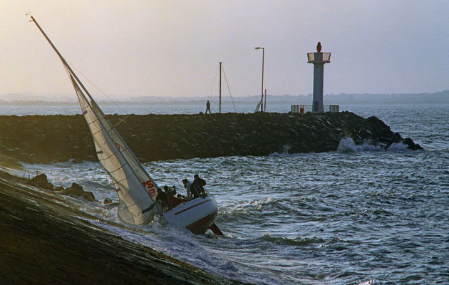
The coast around Coverack on The Lizard is littered with reefs and you need to be careful when moving from one bay to the next when finding a safe haven. Credit: Alamy
Coverack Cove to the east of the Lizard is a useful passage anchorage that is marked on most charts.
The anchorage is protected by reefs to both north and south, the reef and point of The Guthens being very effective in winds from the south-west and possibly even further south, particularly when the swell from the same direction is not too large.
Despite its somewhat exposed situation this is a surprisingly well sheltered bay in the majority of weathers, with good holding on sand.
Care is needed to avoid the Manacles reef if heading from Coverack to Falmouth. A little to the south lies the fair-weather anchorage of Housel Bay, a recognised passage anchorage.
Just to the north-east of that you’ll find Church Cove, virtually unrecognised other than by Ken Endean in his book Channel Havens, but a reasonable anchorage provided there is little south in the wind.
Continues below…
Sailing around Britain and Ireland: All you need to know
Sailing around Britain and Ireland and into its nooks and crannies is always an interesting endeavour. You get to know…
10 classic pilotage mistakes in navigation…
…and how to avoid them. James Stevens reveals the classic pilotage mistakes and explains what you need to do to…
8 uses for a kedge anchor
Is your kedge anchor lying forgotten in its locker? Vyv Cox outlines 8 ways you can put it to good
More tips on using an anchor
Duncan Wells passes on even more tips on using an anchor to help with boat handling, how to drop ground…
Inspection of the chart suggests that this would be preferable to Housel Bay in typical southwesterly swells. Ken notes that there may be powerful surge sufficient to prevent landing ashore.
With luck it may be only a little uncomfortable aboard but Coverack is not far away and should be more protected.
The seabed is mixed sand and weed with some rocks. If the anchorage you have chosen turns out not to be ideal in the conditions on the day, inspect the chart for bays nearby.
This coast is littered with reefs and great care is needed if moving from one bay to the other.
FINDING A SAFE HAVEN CASE STUDY 2: Aberdaron

The sandy bottom here promises good holding and seems a good option when viewed on a chart. Credit: Alamy
The very best pilots provide crucial advice that may not be available on the charts.
Admiralty chart 1971 shows what should be a nice anchorage at Aberdaron on the end of the Llŷn peninsula in North Wales.
The bottom here is shown as sand, the bay faces south and northwesterly winds are common. However, the Glazebrook pilot reveals a potential problem.
Very strong tides flow through Bardsey Sound less than two miles away, the flood causing a counter-clockwise current flowing around Aberdaron Bay, whereas the ebb flows across its mouth.
The current inevitably turns the boat to be beam on to any swell from the south-west, turning a pleasant evening anchorage into a sleepless night.
Anchoring off the tiny beach at Porth Meudwy improves the situation, but be aware there is some weed on the seabed.
Finding unmarked anchorages

A favourite spot is in the Gulf od Volos, between the Sporades and mainland Greece. Credit: Alamy
The examples shown on the previous pages are marked as anchorages on some charts but many unmarked ones are to be found around the world.
One of my favourites is in the Gulf of Volos, between the Sporades and mainland Greece.
We were there recently with a forecast for fresh winds from the south-east.
Our intention was to anchor on the lee side of Nisos Palio Trikeri in Sofia Cove, a double-headed bay that one of our pilots assured us was eminently suitable, being well sheltered from this direction and with good holding.
Our finding was quite different, however, as although well sheltered, the bottom seemed to comprise thin layers of sand and weed over rock that was unable to sustain our normal anchor holding test of 2500rpm astern.
We tried in half a dozen places in both bays but the result was always the same – up to 2000rpm all was well but at 2500rpm, equivalent to about wind Force 6, the anchor dragged and retrieval brought up large clumps of weed.
Eventually we decided reluctantly that the only option was a six-mile beat into Force 5-6 to the far side of the gulf, where we would be in the lee of the Trikeri peninsula.

Vyv Cox is a chartered engineer and has been sailing for more than 50 years
As we sailed past the tiny port of Palio Trikeri we could see that shelter there was not great, and in any case it appeared to be fully occupied with other boats.
Continuing onward, in a few minutes a saddle in the land on Cape Trakhili opposite became apparent about a mile away, with all the appearance of a small beach that had the look of a potential anchorage.
Diverting slightly we headed over to investigate.
As the path on our plotter shows, we initially looked at a bay slightly to the south-west of the more obvious one but the second appeared far more promising.
The seabed was sandy close in, although some weed was evident in deeper water.
Protection from the chop was perfect and the wind seemed lighter.
We anchored in about 3m and spent a peaceful night. The anchorage is not shown in either of the pilots we carry.
Conclusions
Although anchorages shown in pilots and charts are most welcome in normal prevailing conditions, it is perfectly possible to find others when conditions are not average, by examination of the terrain or the chart.
It may be that what looks suitable is not, due to rocky or weedy seabeds, unusual swell or, as has happened to us, a very loud rock concert and dozens of speedboats, but you can be lucky and convert an uncomfortable night into a peaceful one.
Enjoyed reading Cruising unfamiliar waters: how to find a safe haven?
A subscription to Yachting Monthly magazine costs around 40% less than the cover price.
Print and digital editions are available through Magazines Direct – where you can also find the latest deals.
YM is packed with information to help you get the most from your time on the water.
-
-
- Take your seamanship to the next level with tips, advice and skills from our experts
- Impartial in-depth reviews of the latest yachts and equipment
- Cruising guides to help you reach those dream destinations
-
Follow us on Facebook, Twitter and Instagram.


