


Radar is now more efficient, more affordable and far more advanced than even a few years ago. Rachael Sprot explains how to use rader to keep clear at sea

The life of a radar on board a cruising yacht is an easy one. Aside from a few hours of action when it’s misty or foggy, its younger sibling, AIS, does the heavy lifting of collision avoidance for most yachts.
Once the preserve of large yachts and commercial vessels, however, radar is increasingly found on yachts under 40ft. It’s become more affordable, easier to install and more intuitive to use, but how about its operators? Have we advanced with it and are we using it to its full potential? I suspect not.
Like many cruising boats, the Challenge 72 that I co-skipper, CatZero, constantly receives and transmits AIS data. Since it runs in the background the volunteer watch leaders soon become familiar with it. The all-new B&G Halo 24 radar is turned off until needed.
I took the opportunity of a light airs delivery from Cherbourg to Portsmouth after the Fastnet Race to introduce the crew to the new tool, and become better acquainted with the latest technology myself.

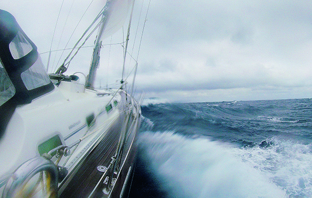
Collision avoidance can often be easier with radar than with AIS
How radar works
With radar, more than any other equipment, it’s important to understand how it works – what it can do and, more crucially, what it can’t. Radar stands for RAdio Detection And Ranging. It works by emitting a powerful radio wave and then listening for the echo as the signal bounces off objects in range.
By timing how long the echo takes to return it can calculate distance with precision. Angles are harder to differentiate: the beam width of a traditional radar is 3-4° wide, which makes bearings less accurate than range.
Not everything makes a good reflector. Metallic surfaces are best, GRP and wood are poor reflectors and carbon fibre lies somewhere in between. Shape matters too: a curved or irregular surface is more likely to return some of the signal in the right direction than a single plane, hence the angular, slab-sides of stealth ships. Water is a good reflector which can be problematic, given the sailor’s operating environment.

What is the range of radar?
Radar range is limited by height. The radar horizon is 2.2 x √height in metres. Although CatZero is a 72ft boat, the radar is mounted on a 4m high arch giving a horizon of only 4M to low-lying objects: 2.2 x √4m = 4.4M.
The range of target detection is increased by the height of the target. A ship with 25m freeboard would be detectable much further away than a semi-submerged container, or other half-sunk nasties. 25m of height adds 11M to the detection range: 2.2 x √25 = 11M.
You can then add the height of your radar to the height of the target to give you a combined maximum range. In this instance, a combined height of 29m, giving a maximum detection range of 15.4M, giving you more time to spot large container ships that tend to travel faster.
Most of the energy from a radar beam is concentrated within 12.5° above and below of horizontal. Unless gimbaled, much of the available energy is heading for the sea or the sky, reducing the range when heeled. Leisure radars normally have a maximum range of 24 – 48M. Unless you’re searching for high land or very large ships, 12M is more realistic.

Yachts are poor radar targets, so need passive radar reflectors, and ideally active radar enhancers, like the mast-head Sea-Me on this Vancouver 32
How to set up radar on a yacht
One of the challenges of traditional radar was the set-up. Brilliance, gain, range and tune controls all required adjustment. Each time you changed the range, you needed to adjust the tune and gain settings too.
Modern radars have automatic tune and gain controls. Preset modes, such as harbour, coastal and offshore, optimise the settings for those environments. In Harbour Mode the antenna spins faster, giving a higher refresh rate to the picture, which is important in close quarters scenarios. Offshore mode will assume a sea state of 2m and rotate slower, which gives the radar energy a better chance of reaching targets further away.

You may want to adjust the auto settings so you can see rain squalls. Photo: Graham Snook
With the ‘instant on’ of digital radar, it takes much less time to bring up a useful picture.
Today’s sets are normally integrated into the chart plotter display. The advantage of this is that you can overlay radar information onto the chart plotter which acts as a check and balance for both systems, but it can lead to quite a busy screen.
Radar gain
Gain adjusts the sensitivity of the receiver. With the gain too high the screen becomes unreadable with noise; too low, and the picture will be beautifully clear, but could start to eliminate small targets. The auto-function on the Halo-24 worked well and allowed for quick range adjustments. However, my preference is to adjust the gain manually every now and then to scan for weaker targets.

Drop the VRM and EBL on a target as a quick way to check if it’s moving towards or a away from you, and whether it’s on a steady bearing
North Up, Course Up, Head Up?
The page can be displayed as north-up, course-up or head-up. Both north-up and course-up are stabilised, one to the compass and one to the course being steered at the time of selection. Head-up is un-stabilised and presents the data as it appears in that moment. With every swerve of the helm the relative positions of targets on screen shift, making it difficult to assess risk of collision.
We selected north-up, offshore mode and a 6-mile range for crossing the shipping lanes. This is a good default for collision avoidance. At this range it’s easier to identify smaller targets, which only become visible close by, whilst allowing time for avoiding action when larger vessels come into range.
Rain and Sea Clutter
Since water reflects radar energy well, it often shows up on screen either as sea or rain clutter. There are tools to eliminate this, but they need to be used with caution as they can remove targets too. Use them sparingly and turn them off regularly to ensure no genuine targets have been eliminated.

If not gimbaled, heel beyond 12º will significantly reduce your radar’s maximum range. Photo: Peter Brogden / Alamy Stock Photo
It’s all relative
Radar sees things in relative motion: we are stationary in the centre of the display and things move around us. Relative motion is the language of collision avoidance: we don’t need to know that another ship is travelling at 12kn on a COG of 123°, we need to know whether we’re converging or diverging.
Anything tending towards the centre of the screen is a threat but, unless we’re stationary or being overtaken, it’s unlikely to be heading straight for us. It is the combination of our courses which creates relative motion, and we must not mistake this for the true motion of the other vessel.
It’s possible for a radar to process the raw data of relative motion and convert it into true motion, which is how a chart plotter displays AIS targets, but it’s complicated. Relative motion is what we want for collision avoidance, so true motion is rarely used.
ARPA and MARPA
Merchant ships use ARPA – Automatic Radar Plotting Aid – to track targets. ARPA locks onto an object and calculates the other vessel’s course, speed and CPA. Leisure radars often have a simplified version of ARPA called MARPA, where the M stands for Mini. I’ve always found MARPA to be flighty and didn’t test it on the day as we ran out of time. It needs good heading and GPS inputs, so has probably improved considerably as the quality of instrumentation has advanced.
VRM and EBL
My preferred tool for target tracking is much simpler: the VRM – Variable Range Marker; and EBL – Electronic Bearing Line. They are the hand-bearing compass of the radar realm and will track targets without the need for any computer or human processing.

A host of targets coming straight for you might look scary, but you may well be sailing through an anchorage. Photo: Clint Westwood/Alamy Stock
Radar target tracking
Traditionally navigators tracked targets on a plotting sheet, taking a position every three minutes. After six minutes there would be three plots. Drawing a line through these indicates their relative motion.
The CPA (closest point of approach) is the point on this line which comes closest to the centre of the screen – us. We don’t know the other vessel’s aspect from this, just that they’re crossing well ahead. However, we could work out their course, speed and aspect using vectors. We know our own course and speed and we know the effect of our combined motion, so we can
work out the missing element: their course and speed.
Having done a 6-minute plot, which is 1/10th of an hour, we can easily calculate how far we travelled in that time. At 6 knots, we covered 0.6 miles. We know our heading, in this case 018°, and can draw on our side of the triangle, working backwards from the first plot.
Article continues below…
AIS vs radar: Do you really need both?
AIS and chartplotters have come a long way in the last decade, but are they enough to replace radar? Jonty…

Collisions at sea: The best tech to help you stay safe
Keeping a good lookout may still be the best way of avoiding collisions at sea, but there is a battery…
Then it’s a case of measuring the third side of the triangle to find out their course and speed. In this instance they travelled approximately 1M in 6 minutes, so must be doing a speed of 10 knots. Measuring their heading shows they’re on a course of 295°.
The examiner’s trick question is a target on a reciprocal course, approaching slowly. Normally the speed of approach of two head-on vessels is fast.
By overlaying our own course and speed onto the plot we identify the target is 0.6M closer than their first position, which is the distance covered by us in six minutes. There is no triangle here: the only vector is our own. This target is stationary and won’t budge!
Radar plotting is laborious, but understanding the part your course and speed plays in relative motion enables a more multi-faceted radar interpretation.

At close quarters, a more powerful signal is bounced back and can create echoes
Do you need AIS and radar?
In the age of AIS, there’s an argument that radar is superfluous. AIS is becoming ever more ubiquitous; we don’t just fit it to our boats, we fit it to ourselves in the form of emergency beacons. It doesn’t suffer from blind spots and it provides more information about other vessels.
However, not every vessel or floating object transmits on AIS and it relies on the data transmitted by them being precise. The same MCA guidance advises that AIS is not yet part of the COLREGS and it should be used to enhance situational awareness rather than relied upon as the primary tool when hoping for collision avoidance.
Although AIS gives a CPA, it’s not always apparent whether the clearance is ahead or astern of the other vessel, which is a drawback. Some newer chart-plotters can show this, but not all of them. Furthermore, on sailing boats where speed fluctuates, the CPA can vary significantly, making it a crude tool for assessing risk of collision.
There is a risk of mistaking precise information – such as a CPA calculated to a few metres – for valuable information. More often it is the broader trend that matters. A radar display with VRM and EBL markers shows the risk of collision with simple clarity.

Objects such as boom and rigging can create blind spots as well as target echoes
Conclusions
What I do know is that we should never believe everything we see on screen. Whether you’re using AIS or radar, no system is entirely comprehensive; they all have their drawbacks. I asked Richard Jennings at B&G whether digital radars were any less prone to blind spots. ‘No, that’s just physics,’ he quipped. You need to know how radar works in order to be wise to these, and then you need to know your radar to understand its idiosyncrasies.
The latest radar technology is impressive – it is quick and easy to set up, and draws much less power so can be left on in the background. I was completely sold on the Halo’s Doppler Velocity Track function. The Raymarine Quantum 2 has similar capabilities, and it feels like a genuinely big leap forward, especially for busy waterways with multiple targets to track. Preset modes and automatic gain and tune controls saved time and reduced the chance of user error. Other radar manufacturers have taken a similar approach.

You shouldn’t need to use VHF radio calls to agree actions as these are in the rules, and voice calls can add confusion
‘We needed to make it easy to get the basics rights,’ said Richard Marsden of Raymarine. These advancements haven’t eliminated all the pitfalls of interpreting it – only training and practice can do that. Courses run by the RYA or Raymarine are an important investment alongside the equipment.
Radar isn’t high on the shopping list if you’re sailing coastal passages with relaxed time-frames. If you’re prepared to wait out poor visibility and sail mainly in the summer the chances of being caught out by fog are reduced.
However, the trip across the Channel reminded me how unnerving fog can be. When the visibility closes in you want all the help you can get, and for vessels making more ambitious voyages, such as CatZero, radar is an extremely powerful tool.
Enjoyed reading this?
A subscription to Yachting Monthly magazine costs around 40% less than the cover price.
Print and digital editions are available through Magazines Direct – where you can also find the latest deals.
YM is packed with information to help you get the most from your time on the water.
-
-
- Take your seamanship to the next level with tips, advice and skills from our experts
- Impartial in-depth reviews of the latest yachts and equipment
- Cruising guides to help you reach those dream destinations
-
Follow us on Facebook, Twitter and Instagram.