


With an up-to-date chart to hand, this lovely anchorage in the Frisian Islands can be found hidden away at the eastern end of the island, suggests Detlef Jens
The Frisian Islands are a wonderful pearl necklace stretching from The Netherlands in the west to the German Bight in the east.
Behind them lie the wonders of the Wadden Sea, which is a Nature World Heritage site: this ever- changing land-and-seascape is unique in the world.
Fresh water mixes with sea water, mud flats are exposed twice daily at low tide, and the entire area is home to a fantastic diversity of ingeniously adapted plants and animals.
The Wadden Sea is a protected area and you should have up-to-date charts on which the various zones that are prohibited or restricted are clearly marked – very practical and detailed are the new chart atlases published by NV Charts, in this case DE 12 or DE 13 (eu.nvcharts.com).
Also, the channels shift and move along with the rest of this semi-submerged world and so always follow the buoys or, in the smaller channels behind the islands, withies that mark them – these are re- laid each spring after the winter storms have changed the scene.
The markers are always much more accurate and up-to- date than even the latest chart!
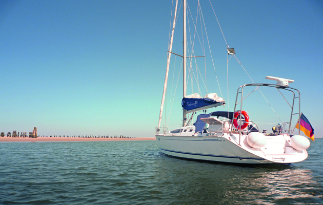
There is a lovely anchorage tucked away behind the deserted and very romantic eastern tip of Wangerooge.
It can be accessed from the North Sea (in calm weather only) through the ‘Blaue Balje’, proceeding with caution on a rising tide following the red markers.
There also is a safer High Water passage across the drying mudbanks south of Minsener Oog that leads from the deep water Jade River to the deep channel of Minsener Balje, which in turn leads out to the Blaue Balje and to the anchorage.
The Blaue Balje has about 2m at Low Water, while the mud passage from the Jade dries to a height of about 1.7m.
The anchorage is just south off the eastern tip of Wangerooge where, with some luck, you will see seals and other wildlife.
Many decades ago this used to be a ferry landing and the leftover wooden piles ashore make a good landmark.
If your boat is shallow draught or suitable for drying out then you can go in close to the beach but if not, anchor beyond the two red bouys in the deep water of the Blaue Balje.
When ferrying ashore in the tender, do take care of the tidal currents, which run quite strongly at times.
Other than fantastic scenery there are no facilities here but provisions, restaurants and all the rest can be had in the island village, which is accessed from the main harbour at western end of Wangerooge, by a little ‘Thomas the Tank Engine’ toy-like train.
There is a passage, marked by withies, from the anchorage south of the island.
The highest point of that would be estimated at 1.6m at Low Water.
I would embark on this passage from the anchorage just before High Water, to be at the highest point roughly halfway along the island at High Water.
After that, the channel becomes deeper as you go along and is again marked by red bouys.
Access to the harbour is dependent on draught and wind direction – an easterly wind significantly reduces the water levels – but with a draught of under 2m should be OK until about half tide.
Wangerooge is a friendly island with a little yacht club that has a bar on stilts by the harbour and is well worth exploring.
It has some fine beaches and is safe for the kids as there are no cars – only horses, bicycles and the one little train.