



Author of the new Shell Channel Pilot, Rachael Sprot, highlights one of the most underrated cruising grounds in the English Channel
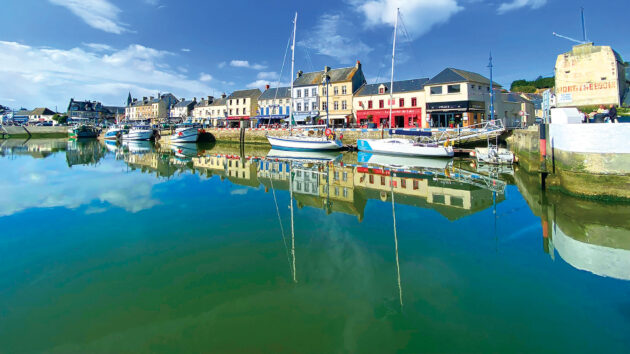
The Shell Channel Pilot covers 99 ports in the Channel, along with numerous anchorages. Revisiting all of them over the course of three years, it was the Baie de Seine which threw up some of the most unexpected pleasures.
The 50-mile wide bight along the coast of Normandy stretches between the major headlands of Cap d’Antifer and Pointe de Barfleur, and its dozen or so ports make for an intriguing cruising ground. It’s often overlooked as a sailing destination in favour of more dramatic coastlines further west – Normandy is the B-side to Brittany’s A-side.
The modest landscapes, tide-restricted ports and scarcity of anchorages mean that many people sail straight past, but they’re missing out. This stretch of coast has an understated beauty, is steeped in culture and history and has plenty to offer visiting sailors.
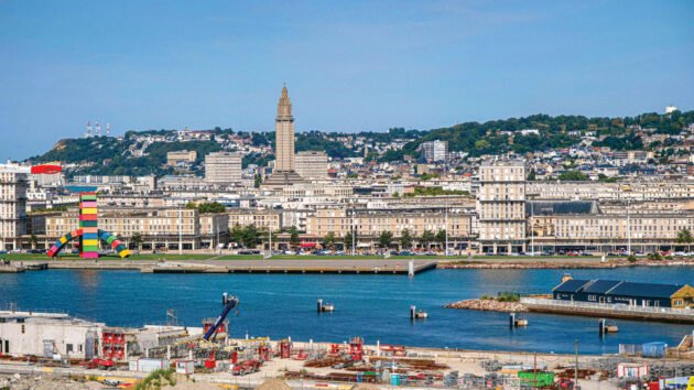
Modernist masterpiece St Joseph’s Church is a highlight of any visit to Le Havre. Photo: Darryl Brooks / Alamy Stock Photo
Well-sheltered from the prevailing southwesterlies, the Baie de Seine is dominated by two big estuaries. The Seine disgorges into the southeastern corner, distributing silt and sediment far out to sea, and four smaller rivers empty into the other corner, creating another shallow, sandy estuary, the Baie
du Grand Vey.
The main port for the Seine has migrated to seaward over the years and is now firmly established at Le Havre. It’s a zone of major industry and large volumes of shipping. Engine failure delayed us here for several days and we were delighted to discover a bright, energetic and art-filled town.
Razed to the ground by the Allies during the Second World War, the rapid reconstruction led by the architect, Auguste Perret, has earned it UNESCO World Heritage status. It’s worth going to Le Havre just to see his masterpiece, Église Saint-Joseph, which is magnificent.
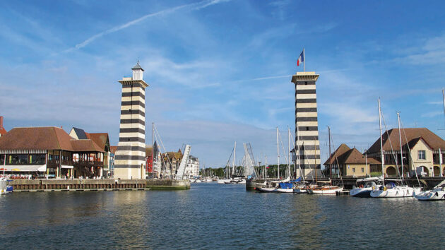
The lifting bridge into Bassin Morny at Deauville, with the waiting pontoon on the port side. Photo: Rachael Sprot
Historic ports
Smaller ports are equally worthy of a visit. Honfleur, the original seaport for the Seine, is all cobbled streets and half-timbered houses. The endless, sandy beaches at Dives and Deauville were linked to Paris by the railway in the 19th century, creating several grand resorts with glorious villas and glitzy casinos, now weathered by time.
Ouistreham, the seaport for Caen, has some of the best repair facilities. Caen itself, seat of William the Conqueror and his wife Matilda, is an attractive, cosmopolitan city.
The southwestern corner of the bay is much less developed, with a charming backwater feel. There are modest working ports where the fish is tide-fresh and the pace of life is slower. Port-en-Bessin, Saint-Vaast-la-Hougue and Grandcamp-Maisy all have fantastic seafood restaurants around their working harbours. Throughout the area, summer markets are piled high with local produce, making it an excellent destination for foodies.
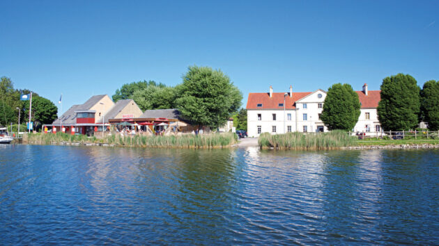
The view from Carentan’s pleasure lake. Photo: David South / Alamy Stock Photo
Carentan deserves a trip for its approach alone. It’s an uncharted crossing of the Baie du Grand Vey before transiting a long canal to a grand Napoleonic basin flanked by an avenue of trees.
It’s an arrival fit for an emperor, but the only audience you’ll have is the bemused cattle munching on the salt marshes and the equally bemused motorists on the main road to Cherbourg as you float above them on the R19 aqueduct before the marina. The reed-lined marina and quiet town are charming, too.
The Baie de Seine is not without its challenges. Whilst it’s sheltered from the prevailing southwesterlies, many of the harbours are difficult or even dangerous to approach in moderate onshore winds. A northerly Force 5-6 rules out most of the ports between Honfleur and St-Vaast.
While the distances between ports are small, the window of opportunity for exiting the lock at one, and entering the next, can be short. The east-going flood tide favours a west to east transit and can produce good passage speeds, but if you’re timing your departure for an hour or two before high water, to coincide with lock openings, you might not make full use of this kick.
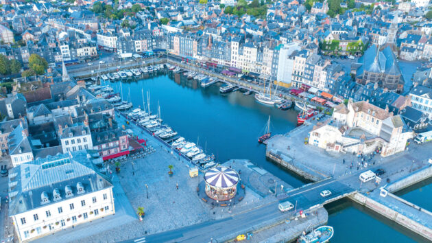
Honfleur’s old basin marina lies at the heart of a town redolent with seafaring history. Photo: Rachael Sprot
Some of the smaller ports are inaccessible to vessels drawing 2m or more at neaps and will struggle to accommodate boats over 45ft. But don’t let that deter you. This is a rich and rewarding cruising ground. Why jostle for space in Brittany, when you can have Normandy all to yourself?
Article continues below…
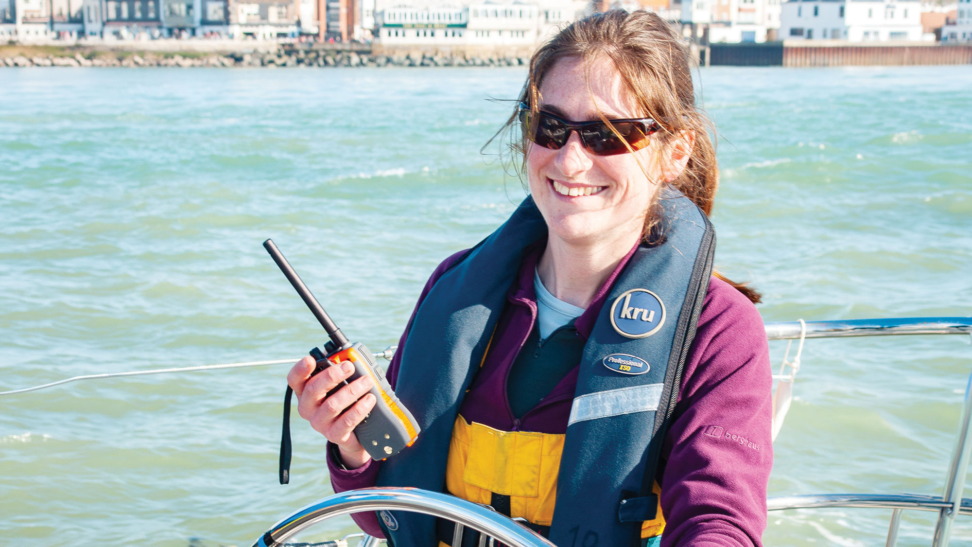
Charting her own course: How Rachael Sprot stepped up to write the iconic Shell Channel Pilot
Producing a new edition of the Shell Channel Pilot after the retirement of Tom Cunliffe was always going to be…
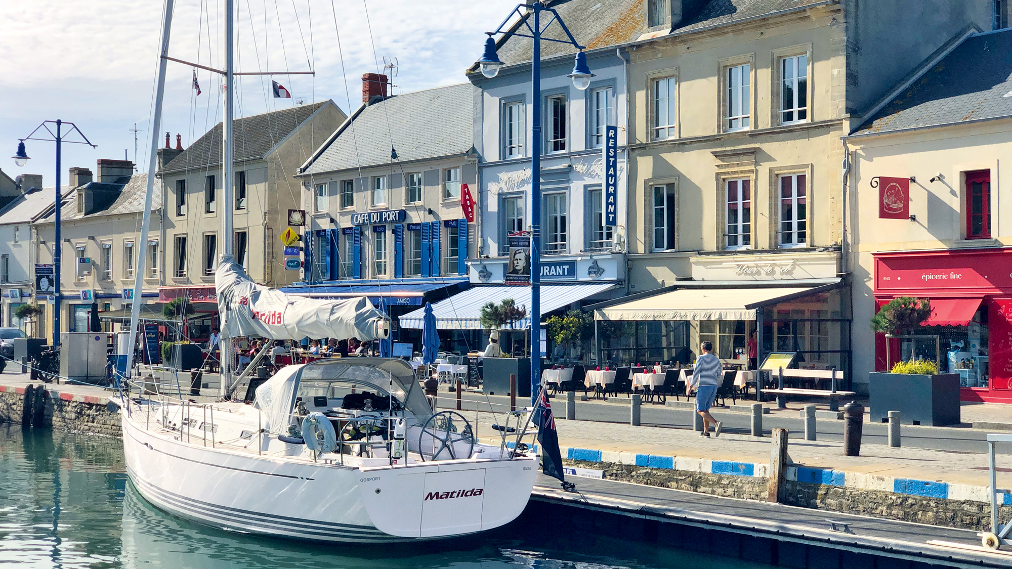
Visiting the D-Day Normandy Beaches by boat
After the evacuation of the British Expeditionary Force from Dunkirk in June 1940, Winston Churchill promised, ‘We will return’. Operation…
Extract from Shell Channel Pilot
Dives-sur-Mer
Dives was one of the places we most enjoyed in the Baie de Seine. It’s almost exactly halfway between Ouistreham and Deauville, which are each a mere eight miles away. Despite the short trip, arrival in the locked marina is hard-earned thanks to the surrounding sandbanks, but it’s well worth it.
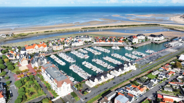
The large, locked marina basin at Dives, with empty visitors’ berths near the narrower entrance
Tides
MHWS MLWS MHWN MLWN
8.3m 1.3m 6.9m 3.1m
Depth
The approach to Dives dries up to 2.8m over a mile offshore, and there’s a drying height of 3.7m just before the marina entrance. However, with High Water neap heights of over 6m, and up to 8m at springs, there’s plenty of water available if timed correctly. It doesn’t help to be too academic about the tidal height, since depths are liable to change. Allow plenty of below-keel clearance and check with the harbourmaster if in doubt.
There’s only 1.5m on the visitors’ pontoon, but the bottom is soft mud.
Comms
Dives Port VHF Ch. 09/ 02 31 24 48 00
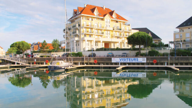
Finger pontoons on the west side are generous, but are silted up with soft mud. Photo: Rachael Sprot
Accessibility
The lock opens approximately HW+/-0300 with a slightly shorter window at neaps and a longer window at springs. In a deep-draught vessel it’s best done in settled or offshore weather with a rising tide. In winds of F5 and above from WNW through to NE, it’s not to be contemplated.
Shelter
Excellent inside the locked basin.
By Night
Not on a first attempt – the outer marks are lit but not the final bend.
The sinuous, drying approach through the estuary of the River Dives swings between encroaching sandbanks and, at times, you might wonder whether you’re approaching through the beach rather than around it. It’s worth the temporary rise in blood pressure though. The departure point for William the Conqueror’s trip to England, the harbour is sandwiched between three towns, all of which are very attractive.
Cabourg to the west is an upmarket 19th-century resort where the town planner went to, well, town. The street plan fans out in perfect semi-circles from that all-important centre of life, the casino (the church is somewhere on the outskirts). Proust spent many a summer here and it appears in his novels as Balbec.
Houlgate, on the eastern side of the approach, lying beneath the Vaches Noires cliffs, is quieter and (dare it be said) a little less ostentatious than Cabourg. You’ll find flowery streets, upscale eateries and a slight whiff of superiority.
Dives, set inland from both of them, doesn’t really have a waterfront anymore, unless you count the 1980s marina development in the basin of a former metal factory. It’s the least glamorous, but most interesting, of the three towns. It has a spectacular 15th-century timber-framed market hall, still in use for its original purpose, narrow winding streets and a relaxed, unassuming town centre.
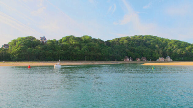
No. 7&8 marks, with the Pointe de Cabourg on the right. Photo: Rachael Sprot
There’s no casino here, but you can take your chances in the slightly terrifying ‘Cave de Calvados’, the wine and spirits merchant beneath the thick walls of the limestone abbey, where no one will hear you scream when you see the prices.
The different characters of the three towns make Dives a rewarding destination. You could easily entertain a crew of any age here for several days.
Navigation
The buoyed channel to Dives is not to be interpreted too literally: the marks are a guide rather than a guarantee of safe water. As always, the channel is much easier to navigate once you’ve seen it at low water, but for a first approach read the contours on an up-to-date chart closely; this is the best guide to where the deep water lies.
Mooring
Dives Marina ££££
The marina basin is huge, with plenty of room to manoeuvre. You’ll probably be met by one of the very helpful marina staff in the dory. There are two sets of berths for visitors, one on either side of the harbour. Those on the western side are reported to be slightly deeper and are more convenient for Cabourg, but when the locks open (six hours out of every 12) you’ll be a long walk from the harbour office.
Mooring bows-to is advisable; it’s shallower towards the wall, but you won’t feel a thing as you settle into the mud. These are substantial finger berths with a low wobble factor, so there’s no need for the armbands and snorkel when you step off.
There are three sets of showers, some beneath the harbour office, and two other blocks on either side of the marina. They’re the usual, measly set-up which manages to make everything in the cubicle wet without directing much water onto the body. Apparently these are an improvement on what went before. Whatever the Normans did for us, it certainly wasn’t plumbing.
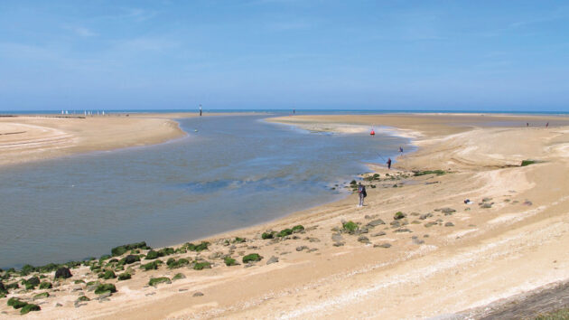
Looking out of the channel from the embankment at low water. Photo: Rachael Sprot
Ashore
The immediate environs of the marina are pleasant enough, but the 1980s development lacks a little soul and a lot of amenities. There are a couple of restaurants at the head of the harbour, including Pizzeria Gaby which does good takeaways and also operates a dépôt de pain for morning croissants.
Otherwise, the town centres of Dives, Cabourg and Houlgate are all a 20-30 minute walk away, or less via the terrifyingly fast e-bikes available for hire at the friendly marina office.
Cabourg is the main centre of action, with water sports and swimming from the beach, mini-golf and a bustling high street with gift shops, ice-cream parlours and souvenir stands. It’s an astonishing relic of a lost age of elegance. Strolling through the chalet-style villas and manicured public gardens of the late 1800s, it’s hard not to be swept up into the fairytale existence of the Belle Époque.
In Dives, the William the Conqueror-themed ‘art village’ in a former coaching inn is worth visiting. It’s the work of a nutty 19th-century art collector who created its medieval look by retrospectively cladding the old, stone buildings in timber and curating an eclectic collection of Renaissance wood carvings in the courtyard.
Euclides da Costa Ferreira, another Dives eccentric, left behind him a mosaic mausoleum to Laika, the first animal sent into space. La Maison Bleue, his curious, beautiful life’s work, is open to the public.
A low-tide walk along the channel and around the seawall to Houlgate is good research for your exit.
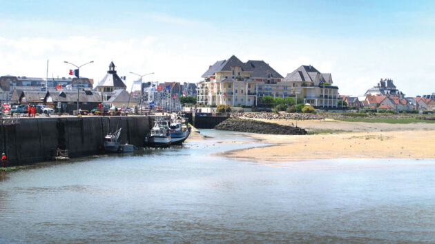
Looking towards the lock approach at low water – the training wall and slipway are clearly visible. Photo: Rachael Sprot
Fuel
Self-service fuel pontoon to port on entry into the marina.
Haul out
30-tonne travel hoist and hardstanding inside the basin operated by the marina.
Pump out
By the fuel dock.
Chandleries
Meca Marine in Dives or Cabourg Marine by the pedestrian bridge across the river. Neither place holds a huge amount of stock.
Groceries
Large Lidl next to the Dives-Cabourg road bridge.
Markets
Dives – Sat AM in the medieval hall. Fish market at the fish dock most mornings. Small open-air market in the marina Tues AM.
Cabourg – Weds & Sun AM plus a night market Sat PM at the Place du Marché. Indoor market on Weds, Fri, Sat and Sun AM.
Houlgate – Thurs AM in the Rue du Général Leclerc. Indoor market Thurs, Fri, Sat and Sun AM.
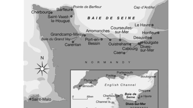
Photo: Maxine Heath
Transport links
The train line runs straight past the marina, but trains are elusive, so the best connections are by bus to Caen and then onwards. The bike hire at the marina office is useful, including a cargo tricycle for large shops.
Repairs
Meca Marine are Volvo agents and engineers. Otherwise, Ouistreham isn’t far if you need riggers or sail makers.
Navigation Guide – The Shell Channel Pilot
Leading marine publisher FB Imray in May published a ninth update to the respected Shell Channel Pilot, now authored by Yachting Monthly correspondent and Yachtmaster Examiner Rachael Sprot.
Rachael Sprot takes over from Tom Cunliffe for the latest edition and has completely rewritten the Pilot based on first-hand research, visiting all 99 harbours over three years. Award-winning artist Mark Entwisle illustrated the guide with colourful drawings that pay tribute to the original Shell Guides edited by poet John Betjeman in the 1930s.
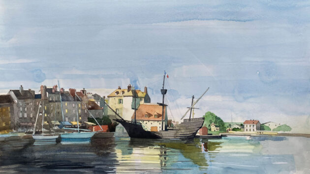
Mark Entwisle’s illustrations pay homage to the original Shell Guides. Photo: Mark Entwisle
Cruising and logistics Pilotage
Dives is identifiable from the peaked, wooded hill, Mont Dives, positioned between the cliffs of Les Vaches Noires to the east, and the low-lying coast to the west. The safe water mark, DI, lies 1.5M offshore, outside the 5m contour line. From here, locate the first pair of buoys, and pass between them, staying slightly west of centre.
Then continue on towards the first of two white posts with green tops, and its corresponding port buoy . Again, favour the starboard side (the port buoys dry), but not too much, the posts are very close to drying heights, too. Once abeam the first starboard post, head down for the second post, leaving it 20-30m to starboard and keeping well off the port buoy.
Now swing slightly to port to head for marks, again favouring the starboard side of the channel but not too closely – there’s a large sandbank extending around the Pointe de Cabourg. The brown hut on the embankment ahead used to be a leading mark for the approach. It’s no longer used but it is marked on the chart and a useful reference point.
Once between No.7 & 8 marks, the channel curves around to the southwest. The deepest water is alongside the seawall, but you want to close with it gradually, so that by the time you’re abeam the first house you’re 10-20m off, and then follow it around to the fish quay, holding close to this side.
The deepest water is now alongside the fish quay. There’s a large shoal in the middle of the harbour here where the River Dives branches off to starboard.
It’s hard to avoid entirely, and dries to 3.6m, but at least by this point you should be out of the reach of any swell. Early in the flood there can be a strong cross-current heading up the River Dives, especially at springs – watch out.
Line up for the lock and stay central on the approach, there’s a training wall marked by a green post to starboard, and the end of a slipway (unmarked) to port. There’s a set of traffic signals on the starboard side of the entrance which must be honoured. The harbour office is on the port side, complete with Bayeux Tapestry frescoes, a not-so-subtle reminder of Dives’s past triumphs.
Enjoyed reading this?
A subscription to Yachting Monthly magazine costs around 40% less than the cover price, so you can save money compared to buying single issues.
Print and digital editions are available through Magazines Direct – where you can also find the latest deals.
YM is packed with information to help you get the most from your time on the water.
-
-
- Take your seamanship to the next level with tips, advice and skills from our experts
- Impartial in-depth reviews of the latest yachts and equipment
- Cruising guides to help you reach those dream destinations
-
Follow us on Facebook, Twitter and Instagram.
Note: We may earn a commission when you buy through links on our site, at no extra cost to you. This doesn’t affect our editorial independence.