


Practical advice for all sailors. Tom Cunliffe has sailed tens of thousands of miles all over the world and has been a Yachtmaster Examiner since 1978
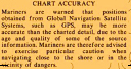
When all else fails… read the instructions! I’ve written before about discrepancies between super-accurate GPS positioning and charted data. Usually I’m talking about making sure you read the survey information and ask yourself whether spot depths from an 1835 leadline survey can be fully compatible with three decimal place WGS84 fixing.
The issue shouldn’t arise if you’re navigating with paper or raster-scan charts because these show, or ought to show, the survey information, allowing you to draw your own conclusions. It isn’t always just a matter of noting specific warnings such as, ‘Satellite-obtained positions must be moved as follows….’ etc. Sometimes, even in home waters, a note like the one above says it all.
None of this information appears on most leisure vector charts, yet the bulkhead chart plotters that use them inculcate a sense of security. Inspect the paper charts carefully first, or check against a single raster chart to see how close to danger you can safely go. You may find the sense proves ill-founded.